Los Angeles County is drafting a new plan for all 51 miles of the LA River. We want you to be a part of the process. Please join us for our first community meeting in Canoga Park at Canoga Park High School on Wednesday, July 25 from 6:00 to 8:00 p.m. to discuss the LA River County Master Plan!
At this meeting community members, local leaders, and representatives from non-profit groups will gather together to discuss the comprehensive vision to the transformation and reimagination of the Los Angeles River. Most importantly, at this meeting, we want and need to hear from you because a reimagined River to connect and serve the diverse communities of Los Angeles County can only be achieved with your input.
What: Community meeting in Canoga Park to discuss the LA River County Master Plan
When: Wednesday, July 25 from 6:00 to 8:00 p.m.
Where:
Canoga Park High School - Cafeteria
6850 Topanga Canyon Blvd
Canoga Park, CA 91303
Please click here to RSVP.
This event is one of the many opportunities available to get involved and share your thoughts on the future of the LA River. To learn about more ways to join the dialogue and provide feedback on the LA River County Master Plan please visit our website at LARiverMasterplan.org and stay connected by following Los Angeles River Master Plan on Facebook and LA River Master Plan on Twitter.
We look forward to working together to reimagine the LA River!
The LA River Master Plan TeamSee the current version of the master plan here:
From: https://la.curbed.com/2015/8/19/9936922/la-river-before-concrete-after
Before photos via Los Angeles Public Library photo collection; afters all by Peter Bennett
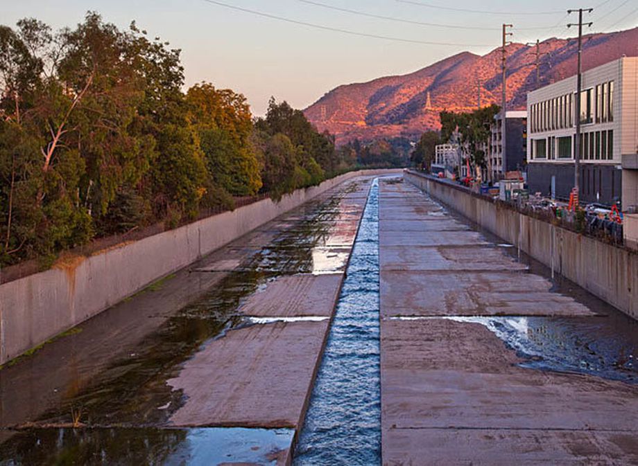
The Los Angeles River is on the verge of a new era. In the few years since the "flood control channel" was reclassified as a "navigable waterway," the region has re-embraced its oddball amalgam of concrete and nature, which winds 51 miles from the San Fernando Valley out to the ocean in Long Beach. A
$1-billion-plus plan to restore 11 miles north of Downtown LA has been working its way through federal approvals, starchitect Frank Gehry has
taken on a revitalization project for the full length of the river that could involve both branding and water reclamation, LA will
host an art biennial centered on the river, the river is a main selling point in the city's
bid for the 2024 Olympics, and
developers are now clamoring to build along the river's banks.
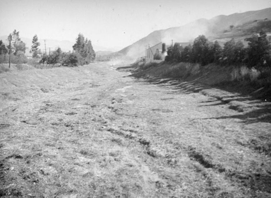
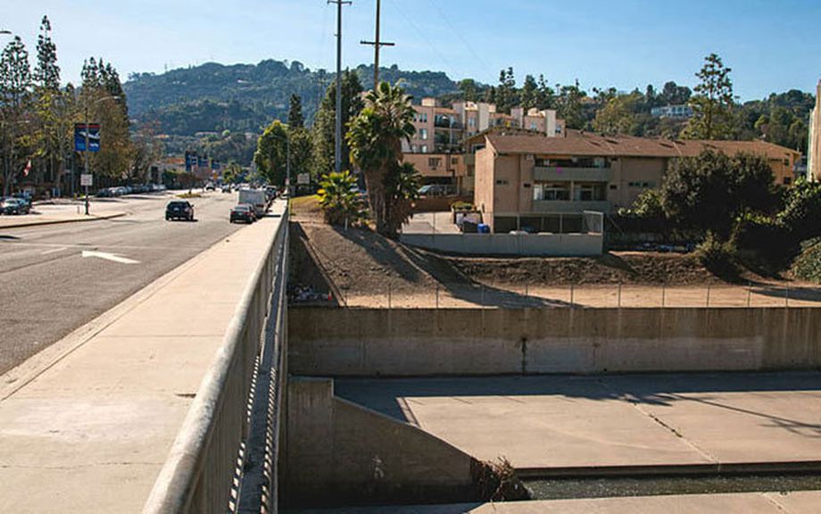
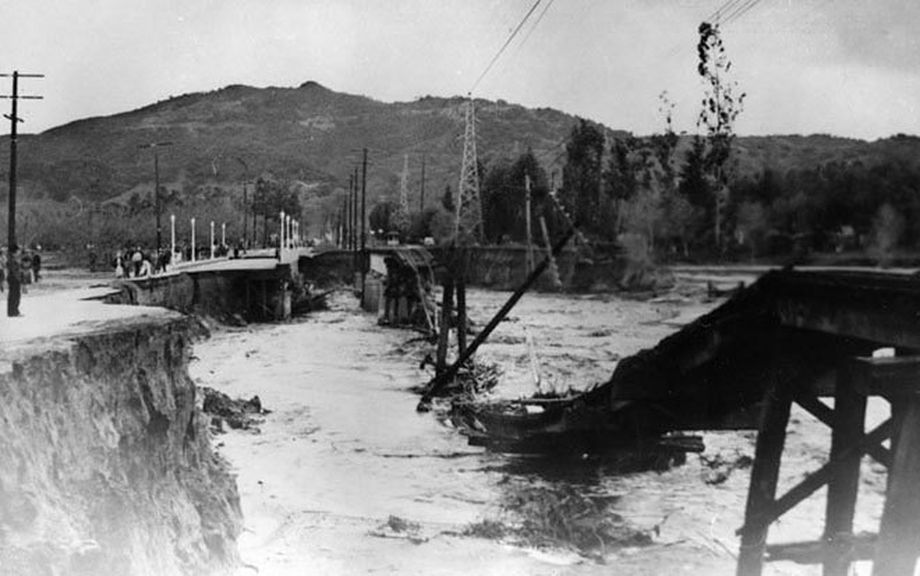
The last time the LA River was reborn it was the late 1930s and it had been drowning the young city periodically since its birth. At some points, the river was just a trickle; in other parts, it was uncontrollably wild, and flooded frequently and devastatingly. After a terrible flood in March 1938, the US Army Corps of Engineers began work to lower the riverbed, widen the channel, and choke the whole thing in "a continuous trapezoidal concrete channel to carry the river from Elysian Park to Long Beach," as described in The Los Angeles River: Its Life, Death, and Possible Rebirth. Gehry thinks the LA River can be great again
with its concrete still intact; the Army Corps hopes to remove at least some of it.
Two years ago, just as the LA River's moment was beginning, we
looked at 25 photos from the LA Public Library's collection showing just how unrecognizable it was before it was paved. Peter Bennett, who runs the
Los Angeles River Photos blog, found exactly (more or less) where nine of those photos were taken, and, using his iPad to match up with the originals, took the same shots of the river as it is today. In an email, he writes:
The idea was to get as close to the original spot the older photos were taken and try to match up the lens and framing with the original. … There was a sense of time travel as I viewed the landscape as it is today and the image on the iPad as it was back in the 30s. The visual contrast was quite striking and the changes apparent in the 75 years or so since the photos were taken was at times quite dramatic.
Here we've matched the two versions together (with Bennett's notes), so you can take the trip yourself:


